We are DL4EO
Deep Learning
for Earth Observation
what we stand for
Sovereign oriented detection for Earth Observation
Open-source tooling, transparent practices, and shared knowledge
for production-grade oriented object detection on satellite imagery
Build and maintain oriented-det as an open-source EO framework
DL4EO is the editor of oriented-det, an open-source package for oriented object detection on satellite imagery — ships, aircraft, vehicles, and more. Oriented bounding boxes are the core representation, not a side feature: they capture heading, footprint, and dense-scene geometry that axis-aligned detectors miss. The framework targets practical workflows from training and evaluation to inference on large EO imagery.
Sovereignty through real open source
Oriented-det is released under the Apache license: auditable, forkable, and free of platform lock-in. Teams can run it on-prem, in a private cloud, or in regulated environments — with no hosted-inference requirement. License clarity matters for institutional and commercial programmes where supply-chain control and long-lived maintainability are non-negotiable. You own the stack, the data path, and the deployment surface.
Share knowledge and raise operational standards
Technology alone does not deliver oriented detection in production — teams need reproducible metrics, sound tiling strategies, and honest evaluation on real EO data. DL4EO publishes benchmarks, documents edge cases, and shares lessons learned so that adoption is built on trust, not black boxes. Training, mentoring, and community engagement remain central to turning open-source tooling into deployable capability.
how we help teams
Our services
Training, support, and project delivery
around the oriented-det framework for satellite imagery
Training and workshops on oriented-det
Hands-on sessions for teams adopting oriented object detection: install and configure oriented-det, prepare EO datasets with proper tiling and annotation, train and evaluate models, and interpret oriented metrics. Formats range from half-day intros to multi-day programmes tailored to your imagery, classes, and deployment constraints.
Consulting and technical support
Expert guidance when you need to move from experiment to production: architecture choices, dataset design without leakage, oriented evaluation, post-processing for dense scenes, and packaging for on-prem or private-cloud deployment. Ongoing support helps your team maintain velocity without rebuilding the stack from scratch.
Project delivery with oriented-det
End-to-end projects to deliver a sovereign oriented detector for your use case — from scoping and annotation strategy through model training, qualification, and deployment. Typical engagements run 3 to 6 months and produce reproducible pipelines, documented metrics, and production-ready containers your team can operate independently.
oriented-det
Oriented bounding box multi-class detection
Oriented bounding boxes are at the heart of what DL4EO builds with oriented-det — our open-source framework for oriented object detection on satellite imagery. Unlike axis-aligned boxes, oriented boxes capture heading and footprint, which matters for ships, aircraft, vehicles, and dense scenes such as harbors and airports.
The live demo below runs a multi-class model trained on the DOTA dataset (15 classes), currently built with MMRotate. It illustrates the kind of oriented detection workflows that oriented-det is designed to make reproducible and deployable on-prem. Demos based on oriented-det will follow in the coming months.
Read announcement View demo
customized detector
Aircraft detection with YOLOv8
Aircraft detection is a recurrent subject for automatic detection in optical satellite imagery. As a consequence, a lot of datasets and frameworks are available for experimentation. The following demonstration is based on the Ultralytics YOLOv8 framework but other frameworks can be used. The model has been trained on a combination of satellite images from various providers. The results are very good and the model is able to detect a large variety of commercial aircrafts in various environments. For military or otherwise specific aircrafts or images, we can turn around a customized detector in a matter of days. Let's get in touch!
Read articleView demo Fused demo
Open innovation
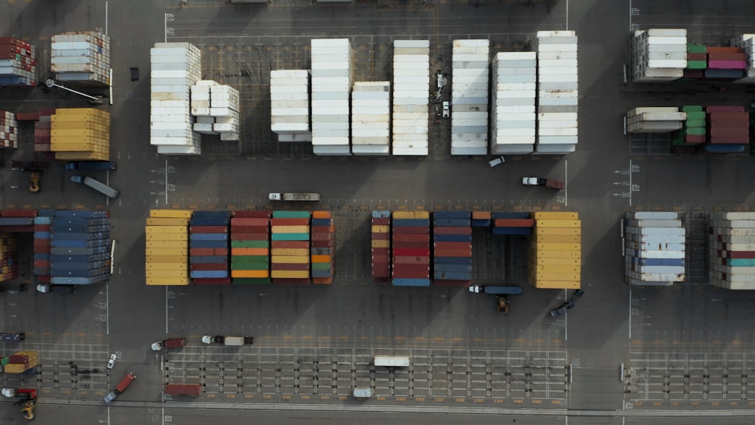
Ship Detection
Depending on the resolution of the satellite images and the size of the ships to be detected, either object detection or object detection architectures can be used. When using segmentation, some specific training and post-processing strategies should be used. With object detection models, we recommend to use oriented bounding box architecture which help with the identification of ships and enable to automatically extract the direction of each ship. We have an extended experience working with oriented bounding boxes frameworks on the subject of ships detection in satellite image with resolution ranging from 1.5 m to 30 cm.
Read articleView demo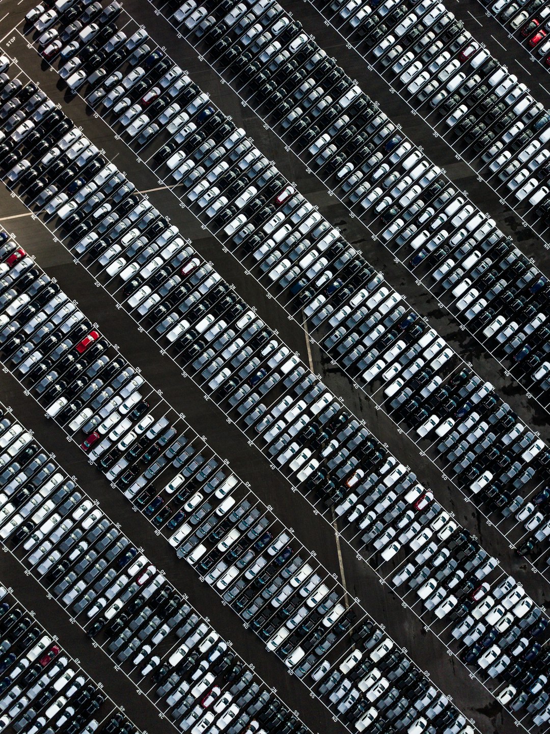
customized detector
Vehicle detection in VHR imagery
Vehicles like cars, buses, trucks, construction and military vehicles can be detected with a resolution under 50 cm. Oriented bounding boxes architectures work well on 30 cm resolution and below. Due to the large variety of vehicles, both civilian and military, the creation of the training dataset also requires a lot of expertise so that it is balanced and not redundant. And in some cases where objects are very rare, using synthetic imagery could help a lot.
Read more (coming soon)View demo (coming soon)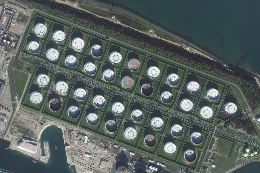
Training and mentoring
Oil storage detection
The oil storage algorithm dectects POL (Petroleum, Oil and Lubricants) tanks visible on satellite imagery (typically SPOT imagery but any other type of medium resolution imagery). It has a minimum threshold of 5 pixels for the diameter of tanks. This is typically a subject that I use for training and mentoring. I have a lot of experience in this field and I can provide you with a lot of insights on how to build a dataset and a model for a specific use-case. I can provide a full traning on scoping the project, generating the annotation, training the model, qualifying it and deploying it on an cloud infrastructure.
Read articleView demo